
Located off the southeastern coast of South Korea, Geoje Island boasts breathtaking landscapes of lush mountains and pristine beaches. And picturesque fishing villages, a warm climate, the Rias coast, numerous islands, coastal cliffs, beaches, mountains, and forests. Also, it is a place where rich history coexists. In addition, due to the abundance of seafood and relatively good transportation for an island, it is one of the most popular tourist destinations for Koreans. Visitors can explore its rich cultural heritage, enjoy fresh seafood delicacies, and partake in various outdoor activities, making it a perfect destination for both relaxation and adventure.
Location of Geoje Island
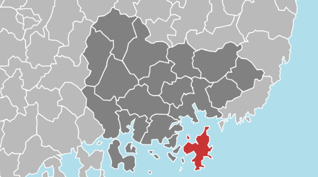
Geoje Island is located in Gyeongsangnam-do and is the second-largest island on the Korean Peninsula. It’s about 50km away from Busan in a straight line. Although it is an island, it is close to the mainland, so Tongyeong City in the west is connected via Geoje Bridge and New Geoje Bridge, and Busan in the north is connected via Geoga Bridge, allowing free land travel.
Weather & Best season to go
The climate is warm and humid. Winter is less influenced by the northwest monsoon, and summer is more influenced by the southeast monsoon. In particular, the average winter temperature in the Jangseungpo and Jisepo areas, which are adjacent to the coast where the Kuroshio Warm Current passes through the Korea Strait, is the second highest after Jeju Island. Also, as is usually the case in eastern Gyeongsangnam-do, it does not snow often.
Although the island has nice weather, it is not recommended to go during the summer months of July and August. Rather, early summer, May and June, is the best time to travel. There is only one reason. It’s a typhoon. Generally, July and August in Korea have typhoons, and it is a very rainy season. Because of this, the southeastern region, where Geoje Island is located, is hit hard by typhoons every summer. If you want to go to Geoje Island, it’s best to avoid July and August.
How to get to Geoje Island
How to get from Seoul to Geoje
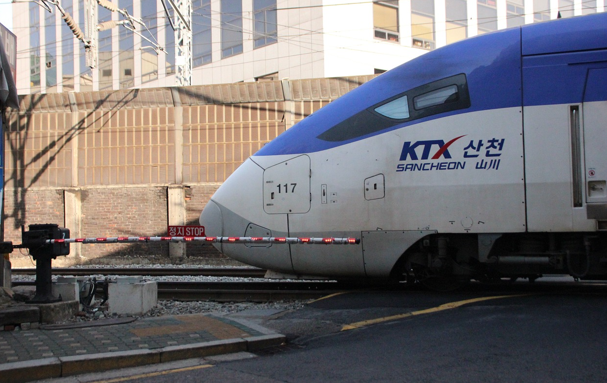
I recommend the express bus as public transportation from Seoul to Geoje Island. Unfortunately, there is no high-speed train running on Geoje Island. There is an express bus departing from Seoul Nambu Bus Terminal and going to Geoje Gohyeon Bus Terminal. It usually runs about 5 times a day and takes 4 hours and 30 minutes. Also, the price is 40,000 won (about 30 dollars). Reservations can be made through the ‘Bustago’ app on the Google Play Store.
How to get from Busan to Geoje
There is also a way to go to Geoje Island directly from Seoul, but I do not recommend this. Although Geoje Island is a beautiful island, it is not a place worth visiting alone. I recommend going to Geoje along with your trip to Busan, which is next to Geoje. First of all, you can read this article on how to get from Seoul to Busan. And if you want to know the basic recommended attractions for your trip to Busan, this article is also good to read.
Getting to Geoje from Busan is easier. Take Busan Subway Line 1 to Hadan Station, then take metropolitan Bus number 2000 to Geoje Island at the transfer center at the station. You will get to Geoje Island in 1 hour and 30 minutes. There is no need to make a reservation in advance, as it runs 39 times a day at 15–30 minute intervals. The first train is at 6:00 in the morning, and the last train is at 22:30 at night. Also, the cost is about 4,000 won (about 3 dollars) one way.
10 things to do in Geoje
Gyeryongsan (계룡산)
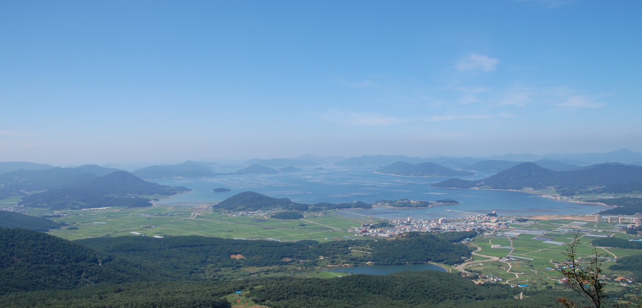
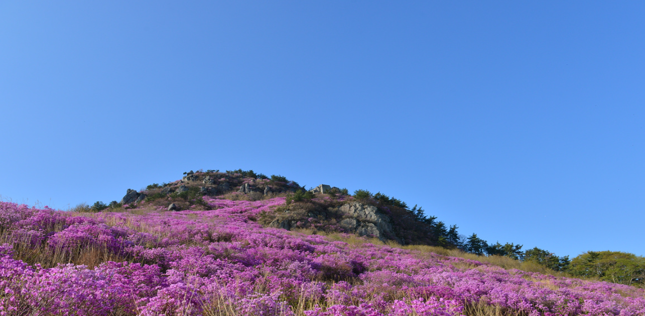
Geoje Gyeryongsan Mountain, 566 meters above sea level, is a towering mountain in the center of Geoje Island. It is said that the shape of the summit of the mountain resembles a chicken comb, and the mountain burped a dragon to form Gucheon Valley. At the top of Gyeryongsan Mountain, there are chicken-comb-shaped rocks, and the view from below is spectacular. On the ridge leading to Seonjasan Mountain in the south, there are the remains of a signal corps built for the convenience of monitoring prisoners during the Korean War. This is the remains of a POW camp in a broad sense, and unlike the ‘fake’ POW camp located in Gohyeon, it is a real POW camp building. Now it is in ruins, and only the building walls remain, serving as a windbreak for hikers.
In spring, mountain azaleas bloom around the main ridge stretching from the summit of Gyeryongsan Mountain to Seonjasan Mountain, creating a spectacular sight, and in fall, the waves of silver grass at Gojasanchi, the hill between Gyeryongsan Mountain and Seonjasan Mountain, delight the eyes. However, the real charm of Geoje Gyeryong Mountain lies elsewhere. The view from here is a combination of the beautiful scenery of the Dadohae Sea in Hallyeohaesang National Park and the exotic scenery of the Joseon Marine Industrial Complex. When people come to Geoje Island, they often only visit Haegeumgang River, Hakdo Black Jinju Mongdol Beach, and Windy Hill, but to truly see the seascape, you have to climb a mountain on Geoje Island. Among these, Gyeryongsan Mountain in Geoje boasts outstanding scenery.
Oedo Botania (외도 보타니아)
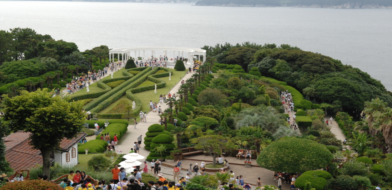
Oedo Botania is a marine plant park located within Hallyeohaesang National Park in Namhae, known for its natural beauty along the southern coast. The walking track is well constructed, with over 3,000 different varieties of trees and flowers to admire throughout the way. There are seven ports that lead to Oedo, and it is recommended to examine the position of the ports based on the path. After the trip, visitors are given two hours of free viewing time. Also, Oedo Island prohibits overnight stays, meals, and vehicle use for nature. This is Geoje’s most popular weekend tourist attraction.
Windy Hill (바람의 언덕)
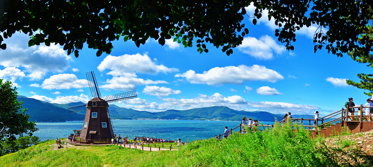
It is a hill located in Galgot-ri, Nambu-myeon, Geoje-si, Gyeongsangnam-do and is part of Hallyeohaesang National Park. A place where the landmark windmill and beautiful scenery of idyllic hills come together. As the name suggests, the sea breeze blows stronger than the surrounding area. Of course, on days when the wind itself is less blowing, it is not that bad here.
It was a quiet place in Geoje Island, known only to those in the know, but it became famous in the mid-2000s with various dramas and the opening of Geoga Bridge. Please note that vehicles and people are very crowded during peak season. There are days when the wind blows strongly and there are days when it is calm.
Starting from Dojangpo Village, Windy Hill is located to the north and Sinseondae, a rough sea cliff terrain, is located to the south. Both places are within walking distance. On both sides of the road leading from Hakdong Mongdol Beach, camellias and rapeseeds bloom in the spring, hydrangeas bloom in the summer, and goldenrod blooms in the fall. Hammok Mongdol Beach and Haegeumgang are nearby. There are various cafes on the hill behind the village.
Geunpo Tunnel (근포 땅굴)
Geunpo Tunnel is a hidden tourist attraction in Geoje, and as word of it is starting to spread that it takes very pretty pictures, many travelers are visiting it. It is located in Nambu-myeon, and there is a tunnel on the beach behind Geunpo Village. It is becoming increasingly known as a photo spot for couples, and the natural scenery along with the sea is very beautiful.
Maemi Castle (매미 성)
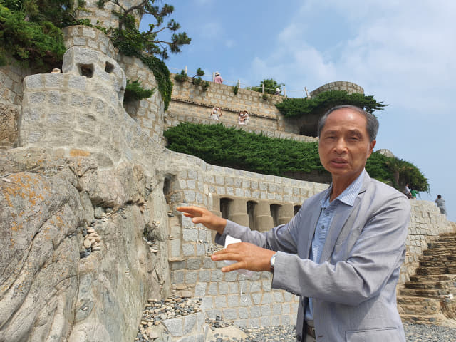
Baek Sun-sam, who has been building this castle by himself for 19 years, originally grew a vegetable garden in Bokhang Village as a pastime when he retired from his days as a researcher at Daewoo Shipbuilding & Marine Engineering. However, in the garden, not far from the sea, all the crops grown in the 2,000㎡ field were washed away and the soil collapsed due to Typhoon Maemi in September 2003.
Baek Sun-sam, who was irritated by this, began building an embankment on the collapsed soil boundary in preparation for the next typhoon. At first, it was built with cement, concrete, bricks, etc. without considering the aesthetics, but it was gradually changed to granite considering the aesthetics, and it was built beautifully taking into account the beauty of nature. After more than 10 years, it has become a huge fortress.
The exterior is made of earth, stone, and cement to withstand typhoons. It resembles a medieval castle in Europe, which is why tourists come here. Surprisingly, this cicada fortress was originally built for windbreak purposes and was built without any design or supervision, but it was eventually built in the shape of a fortress and became a famous landmark in Geoje Island.
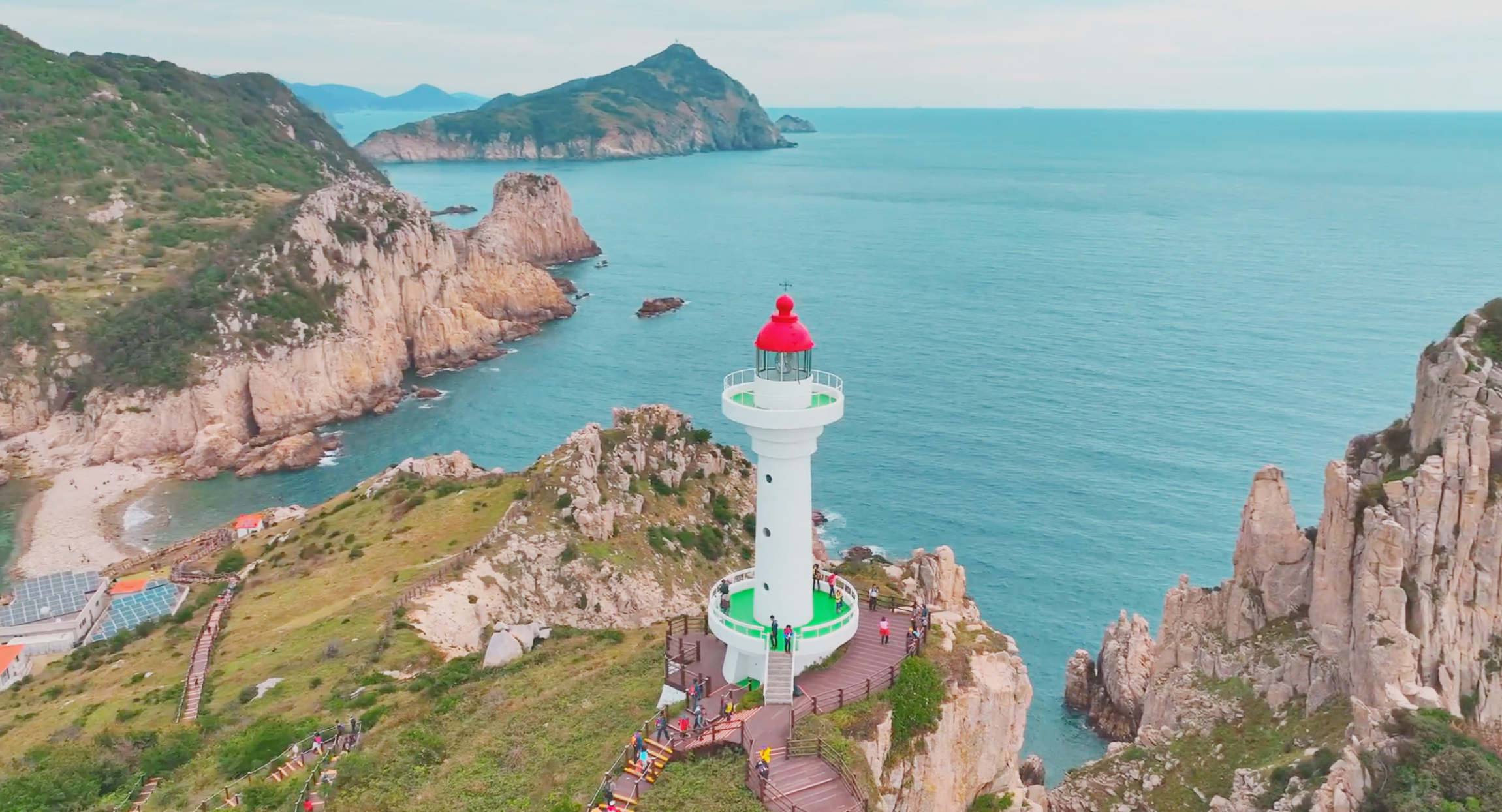
Sinseondae (신선대)
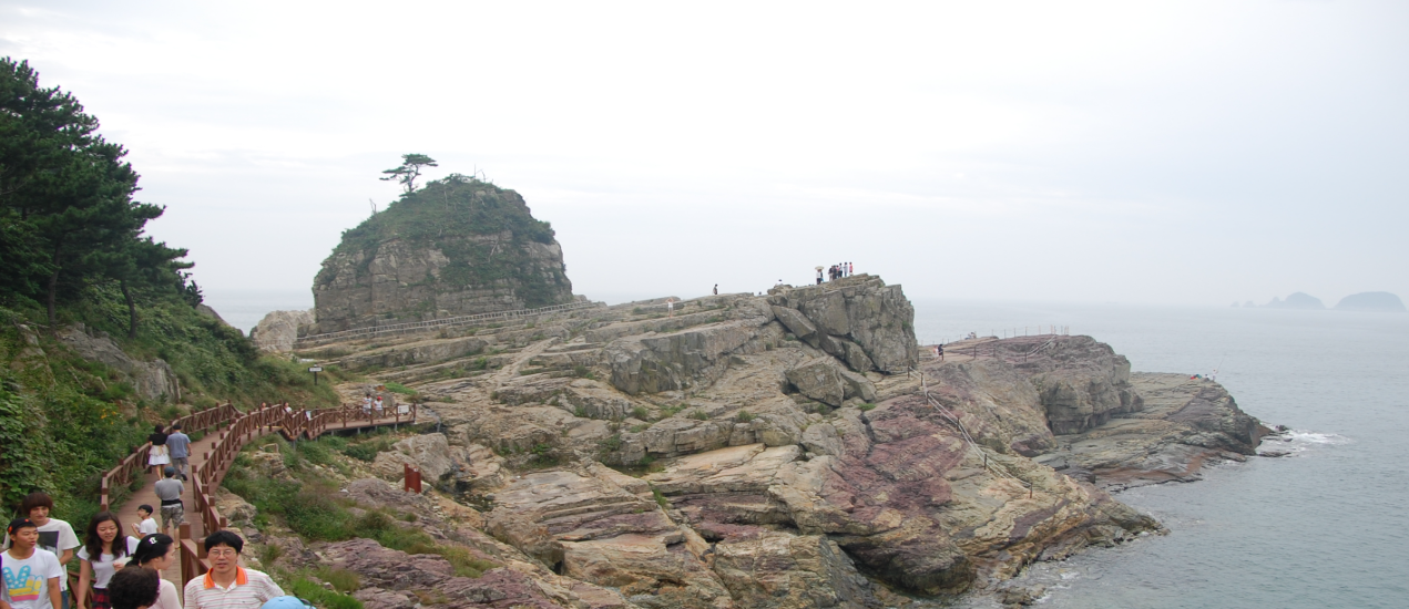
Sinseondae, located in Galgot-ri, Nambu-myeon, is a place with such outstanding natural scenery that it is said that immortals came down to enjoy the arts. It is called ‘Sinsundae’ because it is a place where immortals used to play. Gatbawi Rock, which looks like a scholar’s hat, is used as a ritual for those who want to hold government positions. There is a popular belief that, if you raise it, your wish will come true. The wide rocks make you imagine a hermit playing baduk in peace, and the five-colored rocks, reminiscent of steamed rice cakes stacked one on top of the other, blend in with the surrounding strangely shaped rocks to create a painting.
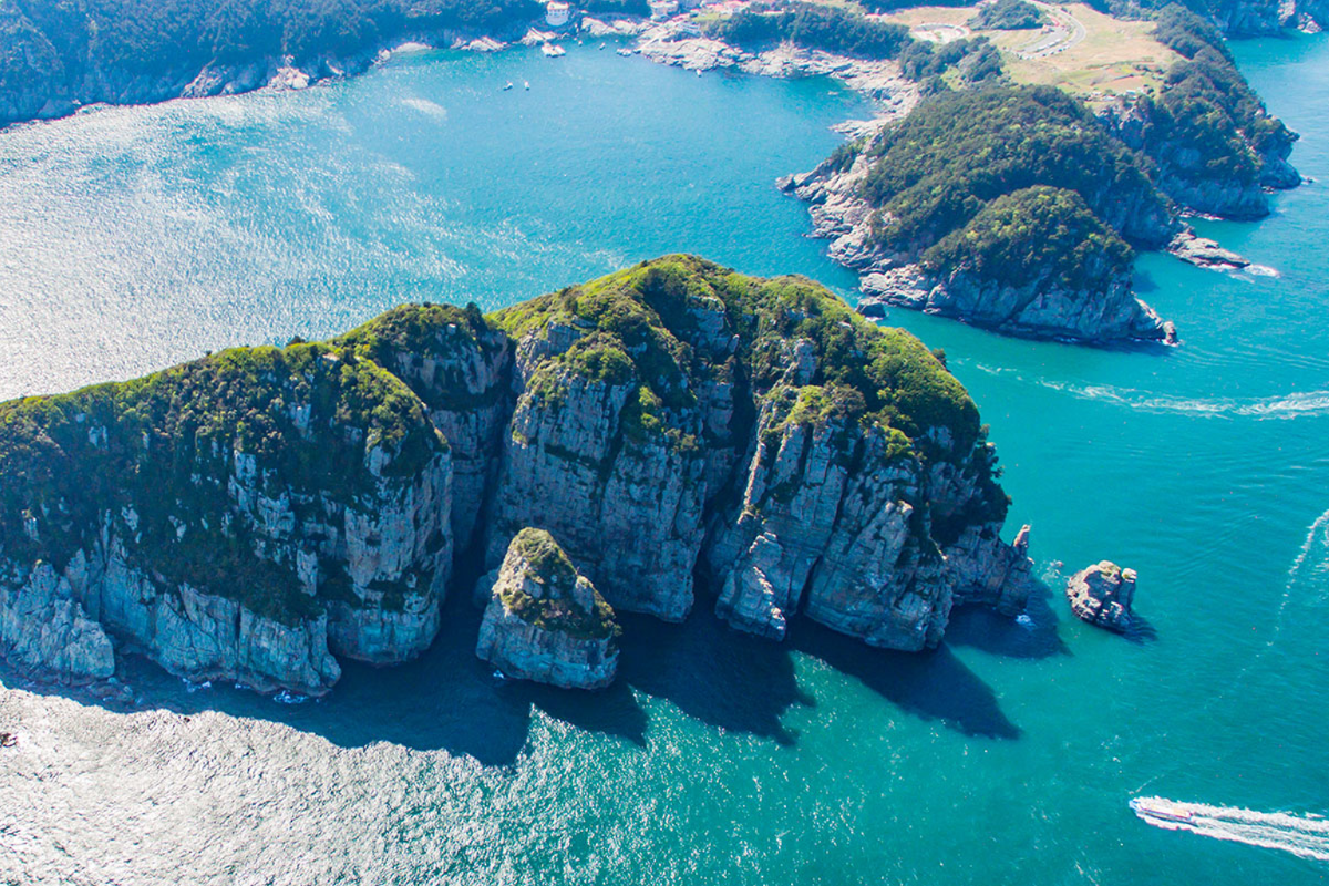
Haegeumgang Islets (해금강)
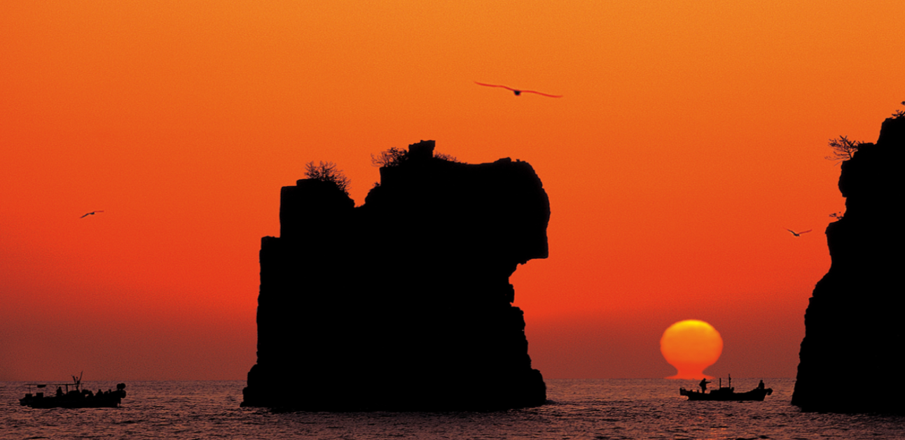
An island in Geoje-si. The name is taken from ‘Haegeumgang’ in Geumgangsan Mountain. It belongs to Hallyeohaesang National Park. Strictly speaking, Haegeumgang is a nickname rather than an official name, but the etymology of the name is that its appearance resembles Mt. Geumgang in the sea. It is a magnificent scene that is difficult to find on the coast of Korea. It has been a representative scenic view of Geoje City since the past and is the oldest famous tourist destination.
Haegeumgang is an island with very steep rock cliffs, so you cannot land directly on it, so you basically take a cruise ship and see it from the sea. You can see it from land if you go towards the end point of Haegeumgang and Ujebong Observatory, but the pictures of Haegeumgang show a spectacular view of the steep cliffs on the sea side, and on the other hand, the view on the other side from land is as ordinary as any other island. Instead, this side is popular for its sunrise view.
Somaemuldo (소매물도)
Somaemuldo is a small island with a 3.8-kilometer coastline southwest of Maemuldo. The distance from Maemuldo Island is only 550 metres, so if you stand on a high peak or ridge, you can see both sides. Somaemuldo Island is one of the most popular among Koreans. This is because the island’s towering appearance against the backdrop of the brilliant cobalt-colored water is stunning, and the marine formations that encircle the coast create a truly wonderful perspective.
However, what makes Somaemuldo Island shine more than anything else is the existence of Lighthouse. The small, uninhabited island, which gained a name as ‘Cookdas Island’ when it appeared as the background of the Cooke Dass snack commercial in the 1980s, was originally called Haegeum Island. Haegeumdo Island became a lighthouse island in 2000 after it was designated as a government-managed area for uninhabited islands with endangered species or excellent topographical and scenic value and vegetation.
Daegeum San (대금산)
It is a mountain at the northern end of Geoje Island that was named for a location where iron was manufactured during the Silla Dynasty. Although it is not a very high mountain, it is gentle and covered in silk-like grass; hence, it is also known as Daegeumsan Mountain, which translates to “silk-covered mountain.”.
In spring, it is a mountain with beautiful azaleas and many tourists flock to see them. The middle peak is called Junggeumsan and there is a fortress built in the late Joseon Dynasty. This fortress is a fortress where residents from three villages, Daegeum, Sibang, and Yulcheon, participated in building the fortress, storing military provisions, and supplying them to each camp on the southern coast. There is a mineral spring here and an altar for praying for rain, and many people come to the mineral spring on Chuseok and the first full moon to bathe and drink.
It is a lovely peak with views of the turquoise South Sea Sea and the pink and white foam of azaleas down the coast. A route around the mountain has been opened, allowing cars to reach the mountain’s center, which is why so many people come here.
There are many hiking trails; they don’t take a lot of time, and they fit well with the island atmosphere of Geoje Island, making it a great place for a day hike that combines hiking and travel.
The typical hiking course is from Sibang (aka Salbang) in Jangmok-myeon, through Bugol, and up to the summit. When you reach the top, you can see Tsushima Island in the distance and Busan Metropolitan City, Changwon Masan, and Changwon Jinhae.
Mongdol Beach (몽돌해수욕장)
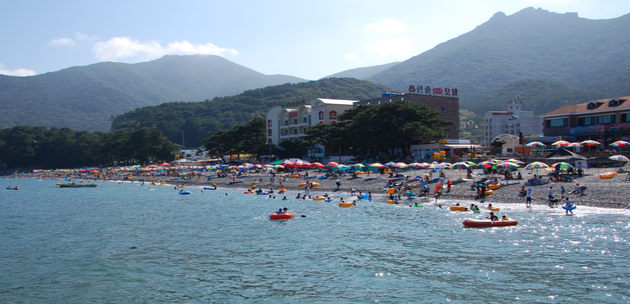
The name of the beach comes from the fact that it is a terrain where cranes soar. If you walk along the coast, you will come across a camellia forest full of camellia flowers. The beach covered with mongdol (small round pebble) and used as a swimming beach in the summer. It is called Hakdong Mongdol Beach or Hakdong Beach.
It is famous for its clear and clean sea water and is known as one of the most popular attractions for families and couples. Most tourists from other places use the course that runs from Hakdong Beach to Windy Hill, Sinseondae, and Haegeumgang, and it is a place where tourist attractions such as Hallyeohaesang National Park and Abidoraeji Pond come together.